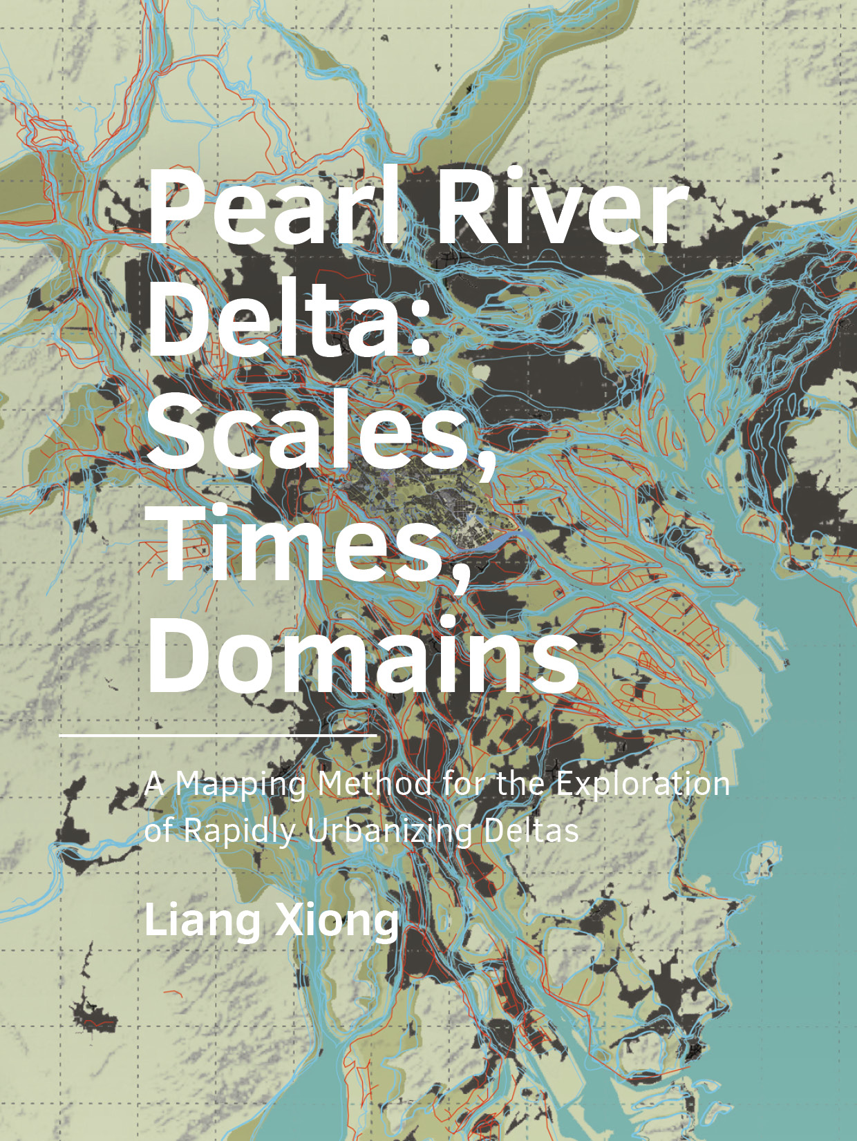
Pearl River Delta: Scales, Times, Domains
A Mapping Method for the Exploration of Rapidly Urbanizing Deltas
DOI:
https://doi.org/10.7480/abe.2020.21.5212Abstract
An implemented design of an urban area not only imposes long-term conditions on societal processes, but also on natural processes. The urbanization of the Pearl River Delta (PRD) is a highly dynamic process that has interfered with many natural and artificial processes in the complex system. The involved human and natural processes, each with their own scale and speed of change, compose the complex urban delta landscape. The dominance of the efficiency-oriented fast urbanization process and its accompanying infrastructure development have put the deltaic social, cultural, and ecological environments at greater risk. Human activities have caused conflicts of a lack of cooperation with nature and coordination with other human activities during the rapid urbanization. The effectiveness of the related plans and designs depends on their capability to acknowledge and adapt to the nature of urban deltas.
The research aims to provide an understanding of an urbanizing delta in which different scales, times, and domains are related to each other; and to examine how this understanding can be used in a planning and design process in a rapidly urbanizing delta. A mapping method is developed according to the key notions in the understanding of urban deltas, namely its systems, scales, and temporality. The systematic mapping approach was used to organize and analyze both short-term and long-term spatial data during the rapid delta urbanization processes by transforming spatial data via scales, times, and domains. The mapping approach works with insufficient data, which is often the case in a rapidly changing environment, to identify spatial challenges from a longterm perspective.
Applied in the PRD, the knowledge of the development of the urban landscape had been inventoried, synthesized, and presented in its own spatial-temporal model using maps. Three types of processes (landscape formation, infrastructure extension, and urbanization) were identified according to their speeds. Spatial interactions were illustratively explained on both the delta scale and local scale from 4000 BC to the present with a time extent ranging from 2000 years to 50 years. The visualization revealed a transition of the regional pattern from a water-based mode to a land-based mode, during which an unawareness of the landscape and a detached urban pattern were developed. The present flooding issue was revealed by identifying the critical threshold signals, namely sudden changes in the spatial pattern of the dike system. Such trends increased the flood risk in the new urban areas on both the delta and regional scales. The mapping approach provided a probable vision of 2080, and a possible alternative vision. The two visions offered both the options of repair and transformation for the discussion of future planning and design. Both empirical and hypothetical mapping were deployed to provide a comprehensive understanding of the delta. Mapping served as a tool with which to not only represent existing knowledge, but also to seek missing knowledge.
The intervention of this mapping framework was applied and evaluated in terms of design, decision-making, and education, and the insights gained were used to discover new possibilities and strategies for the delta. The systematic spatialization approach provided a spatial analysisbased design and planning alternative. In this approach, evidence-based arguments facilitated the cooperation and collaboration of professionals, stakeholders, and the interested public during the planning and design of the delta. During knowledge gathering and the re-mapping process, current stakeholders from different domains were able to collaborate, new stakeholders (the citizens) became involved, and enough awareness of natural processes was created to spur cooperation during the decision-making process. The systematic mapping across scales, time, and domains provided the stakeholders with a new mindset during design and planning, in which they were able to collaborate with each other and develop interventions that could cooperate with the natural process in the rapidly urbanizing delta. The mapping approach also directed possibilities of sustainable planning and design process by generating a circulation among the individual design, collective design, and mass awareness of the PRD. The mapping approach thus served as a vehicle that brought awareness to the spatial relationships, exchange of knowledge, and means of collaboration in both the short term and long term, on both small and large scales, and among different domains and stakeholders.
This study contributes to the knowledge of urban delta planning and design from the following five aspects. (1) It extends the understanding of the differences and mutual influences of the urban and natural dynamics to the highest level by investigating the region with the fastest urbanization process in the past four decades. (2) It provides an approach for the analysis, understanding, and evaluation of the rapid change of urban dynamics on a large scale and with an extreme transition stage. (3) It enables the possibility of achieving a more effective, adaptive, and resilient strategy by providing an understanding of spatial knowledge. For the first time, the complexity and uncertainty of urban deltas and essential relationships (such as natural-human, land-water, and spatialmanagement relationships) on a substantial scale and with a rapid change of speed are explored. Furthermore, (4) this study devises, employs, and tests innovative visualization via multiple spatial and temporal scales. This is required to establish suitable interventions and measures via interactive communication and decision-making during the processes of design, planning, and management with stakeholders. Finally, (5) this study provides an effective data acquisition and analysis method to bypass the issues of data censorship, insufficiency, and inaccuracy in Chinese urban research. In other words, this study provides a strategy to achieve more integrated and resilient delta planning and design. It provides a substantial opportunity via visualization and spatialization to overcome the obstacle of localism among different levels of governments in the decision-making and implementation processes. It also helps to increase public awareness of, and participation in, the planning and design process, which are often lacking in the Chinese context.
References
Baschak, L. A., & Brown, R. D. (1995). An ecological framework for the planning, design and management of urban river greenways. Landscape and Urban Planning, 33(1–3), 211–225. https://doi.org/10.1016/0169-2046(94)02019-C
Bates, D. S. (1991). The Crash of ’87: Was It Expected? The Evidence from Options Markets. The Journal of Finance, 46(3), 1009. https://doi.org/10.2307/2328552
Bates, D. S. (1996). Jumps and Stochastic Volatility: Exchange Rate Processes Implicit in Deutsche Mark Options. Review of Financial Studies, 9(1), 69–107. https://doi.org/10.1093/rfs/9.1.69
Batty, M. (2013). The New Science of Cities. The MIT Press.
Blalock, H. M. J., & Blalock, A. B. (1959). Toward a clarification of system analysis in the social sciences. Philosophy of Science, 26(2), 84–92.
Board of Pearl River Delta Agriculture Gazetteer in Foshan Revolutionary Committee. (1976). Agriculture Gazetteer of Pearl River Delta 2: History of Dike and Recliamation in Pearl River Delta (Board of Pearl River Delta Agriculture Gazetteer in Foshan Revolutionary Committee (ed.)).
Bradshaw, M., & Weaver, R. (1995). Foundations of Physical Geography. William C Brown Pub.
Braudel, F. (1966). La Medtiterranee: La part du milieu. Librairie Armand Colin.
Campanella, R. (2014). Fluidity, Rigidity and Consequence: A Comparative Historical Geography of the Mississippi and Sénégal River Deltas and the Deltaic Urbanism of New Orleans and Saint-Louis. Built Environment, 40(2), 184–200.
Castells, M. (2000). The information age: economy, society and culture, volume 1. In The rise of the network society. Blackwell Publishing.
CBS. (2019). Population on January 1 and average; gender, age and region. Statline. https://opendata.cbs.nl/statline/#/CBS/nl/dataset/03759ned/table?dl=DA8F
Chau, K. W., & Jiang, Y. W. (2003). Simulation of transboundary pollutant transport action in the Pearl River delta. Chemosphere, 52(9), 1615–1621.
Che, W. (2016). Difficulties and Keys of Sponge City Construction. The Twelfth International Conference on Green and Energy-Efficient Building New Technologies and Products Expo. http://www.archcy.com/point/benzdj/1217cc289876a436
Chen, R. (2012). Explaination on Revised River Sand Mining Management Regulation of Guangdong Province.
Chen, Xiaohong, & Chen, Y. (2002). Hydrological Change and Its Causes in the River Network of the Pearl River Delta 珠江三角洲网河区水文与地貌特征变异及其成因. Acta Geographica Sinica, 57, 429–436.
Chen, Xiaohong, & Chen, Y. D. (2004). Human-induced hydrological changes in the river network of the Pearl River Delta, South China. In Yangbo Chen, K. Takara, I. Cluckie, & F. H. De Smedt (Eds.), GIS and Remote Sensing in Hydrology, Water Resources and Environment– Proceedings of ICGRHWE (Issue 289, pp. 197–205). IAHS.
Chen, Xiaowen, Liu, X., & Zhang, W. (2011). Shore Reclamation in Pearl River Esturay and Its Impact Analysis 珠江河口滩涂围垦动态及其影响. Journal of Hohai University(Natural Sciences), 39(1), 39–43.
Chen, Xiaowen, Zhang, W., Zhao, H., Xu, H., & Yi, W. (2010). Spatio-temporal Characteristics and Effects of Shoreline Evolution of the Pearl River Estuary in the Past Thirty Years 近20年来珠江河口岸线演变时空特征及效应. Tropical Geography, 30(6), 591–596.
Chen, Y. D., Zhang, Q., Xu, C. Y., Lu, X., & Zhang, S. (2010). Multiscale streamflow variations of the Pearl River basin and possible implications for the water resource management within the Pearl River Delta, China. Quaternary International, 226(1–2), 44–53. https://doi.org/10.1016/j.quaint.2009.08.014
Chen, Yongzhi, Feng, R., Liu, S., Huang, J., Zhang, G., Li, X., Lv, J., Liang, R., Liu, X., Liu, B., Li, Z., Liao, M., He, J., Huang, J., Chen, W., Hu, N., Ou, X., Zhang, X., Chen, P., … Zhou, C. (1995). Atlas of Shunde Urban and Rural Planning (K. Luo, S. Lu, & H. Huang (eds.)). Shunde Urban and Rural Planning Board.
Christaller, W. (1966). Central Places in Southern Germany (C.W.Baskin (trans.)). Prentice-Hall.
Chung, C. K. (2014). Transformations of Urbanising Delta Landscape. Delft University of Technology.
Clark, W. C. (1985). Scales of climate impacts. Climatic Change, 7(1), 5–27.
Costanza, R., d’Arge, R., de Groot, R., Farber, S., Grasso, M., Hannon, B., Limburg, K., Naeem, S., O’Neill, R. V., Paruelo, J., Raskin, R. G., Sutton, P., & van den Belt, M. (1997). The value of the world’s ecosystem services and natural capital. Nature, 387(6630), 253–260. https://doi.org/10.1038/387253a0
Courtois, P. J. (1985). On time and space decomposition of complex structures. Communications of the ACM, 28(6), 590–603. https://doi.org/10.1145/3812.3814
Cui, S., Wang, X., & Deng, J. (2005). On the River Ecology Issue and Solution of Pearl River Delta River Network. Water Resources Development Research, 5(9), 7–11.
Dammers, E., Bregt, A. K., Edelenbos, J., Meyer, H., & Pel, B. (2014). Urbanized deltas as Complex Adaptive Systems: Implications for Planning and Design. Built Environment, 40, 156–168.
De Hoog, M., Sijmons, D., & Verschuuren, S. (1998). Laagland. HMD (Het Metropolitane Debat). Herontwerp.
de Jong, T. (2004). Legends for Design. In Taeke M. de Jong (Ed.), Sun Wind Water Earth Life and Living; Legends for Design (pp. 549–605). Publicatiebureau Bouwkunde DUT, Faculty of Architecture. http://team.bk.tudelft.nl/Publications/Publicaties Prof. dr. ir T.M. de Jong.htm
de Jong, T. (2012a). Diversifying environments through design. Delft University of Technology.
de Jong, T. (2012b). Urban ecology , scale and identity. In E. van Bueren, H. van Bohemen, L. Itard, & H. Visscher (Eds.), Sustainable Urban Environments: An Ecosystem Approach (pp. 71–89). Springer Netherlands. https://doi.org/10.1007/978-94-007-1294-2_3
de Jong, T., & van der Voordt, T. (2002). Criteria for scientific study and design. In T. M. de Jong & D. J. M. van der Voordt (Eds.), Ways to study and research (pp. 19–30). Delft University Press.
Delcourt, H. R., & Delcourt, P. A. (1988). Quaternary landscape ecology: Relevant scales in space and time. Landscape Ecology, 2(1), 23–44. https://doi.org/10.1007/BF00138906
Doxiadis, C. A. (1968). Ekistics:an Introduction to the Science of Human Settlements. Oxford University Press.
Doxiadis, C. A. (1974). Action for a Better Scientific Approach to the Subject of Human Settlements: the Anthropocosmos Model. Ekistica, 229, 405–412.
Elger, C. E., & Lehnertz, K. (1998). Seizure prediction by non-linear time series analysis of brain electrical activity. European Journal of Neuroscience, 10(2), 786–789. https://doi.org/10.1046/j.1460-9568.1998.00090.x
Feng, Z. (1990). Dongguan Water Conservation Local Gazetteer. Dongguan Water Resources Bureau.
Flyvbjerg, B. (2004). Five Misunderstandings about Case-study Research. In C. Seale, G. Gobo, J. F. Gubrium, & D. Silverman (Eds.), Qualitative Research Practice (pp. 420–434). Sage.
Fuhlendorf, S. D., & Smeins, F. E. (1999). Scaling effects of grazing in a semi-arid grassland. Journal of Vegetation Science, 10(5), 731–738.
Gao, Y., Wu, Z., Lou, Q., Huang, H., Cheng, J., & Chen, Z. (2012). Landscape Ecological Security Assessment Based on Projection Pursuit in Pearl River Delta. Environmental Monitoring and Assessment, 184(4), 2307–2319.
Gemeente Nijmegen. (2011). Ruimte voor de Waal. https://docplayer.nl/23417477-Ruimte-voor-de-waal-nijmegen.html
GeoMet. (1999). The Profession of Geography Alexander von Humboldt and Carl Ritter. Valparaiso University. http://www.valpo.edu/geomet/geo/courses/geo466/topics/humboldt.html
Gerring, J. (2004). What Is a Case Study and What Is It Good for? The American Political Science Review, 98(2), 341–354.
Guangdong Historical Atlas Board. (1995). Guangdong Historical Atlas. Guangdong Map Press( in Chinese).
Guangdong Provincial Department of Land and Resources. (2009). Basic Elements in Guangdong Provincial Standard Map. Guangdong Map Press. http://www.gdlr.gov.cn/cms/directory/StandardMap_gd.jsp
Guangdong Provincial Development and Reform Commission. (2017). 2017年广东省国民经济与社会发展报告. Guangdong People’s Publishing House.
Guangdong Provincial Development and Reform Commission, & Guangdong Provincial Department of Transportation. (2017). Guangdong Province “Thirteen Five Year Plan” of the integrated transportation system development 广东省综合交通运输体系发展“十三五“规划.
Guo, Y. (2005). “05·6”特大洪涝暴戾性剖析——水位十年一遇为何流量百年一遇?. Nanfang Daily. http://news.sina.com.cn/o/2005-07-03/09416335798s.shtml
Hallegatte, S., Green, C., Nicholls, R. J., & Corfee-Morlot, J. (2013). Future flood losses in major coastal cities. Nature Climate Change, 3(9), 802–806. https://doi.org/10.1038/nclimate1979
Han, L., Ji, H., Lu, Y., & Mo, S. (2005). Impact of Sand Excavation in Pearl RIver Delta on Hydrology and Environment 河道采沙对珠江三角洲水情及水环境影响分析. Advances in Water Science, 16(5), 685=690.
Han, X., Long, J., Li, J., Chu, F., Zhang, P., Xu, D., & Yang, H. (2010). Research Progress on the Vulnerability of the Pearl River Delta. Tropical Geography, 30(1), 1–7.
Harvey, D. (1969). Explaination in Geography. Edward Arnold Ltd.
Higgins, S., Mahon, M., & McDonagh, J. (2012). Interdisciplinary interpretations and applications of the concept of scale in landscape research. Journal of Environmental Management, 113, 137–145. https://doi.org/10.1016/j.jenvman.2012.08.027
Hu, W., & He, J. (2003). Built-up Land-cover Change Monitoring by Remote Sensing of Urban Area in the Pearl River Delta Based on GIS. Journal of Remote Sensing, 7(3), 201–207.
Hu, W., Wu, Z., & He, J. (2002). Analysis of the impacts of Recent Urban Development in the Pearl River Delta on Soil Resources Based on RS and GIS. Journal of Natural Resources, 17(5), 549–555.
Hu, Y., & Yin, Q. (2016). Exploration of Spatial Planning Practice in Hainan Province: The Case of Hainan Comprehensive Planning (2015-2030). Urban Planning Forum, 3, 55–62. http://www.airitilibrary.com/Publication/alDetailedMesh?DocID=15633470-201003-201004010077-201004010077-11-20
Huang, B., Qiu, J., Zheng, G., Tang, Z., Huang, D., Du, J., Xu, L., Chen, L., Lai, G., Zhang, Z., Luo, A., Chen, Z., Huang, J., Feng, X., Lin, M., Ji, H., Liang, P., Lian, W., Zhao, J., … Huang, Y. (2006). 广东省主要河道采砂及岸线控制规划 Regulatory Plan of Sand Mining and Coast Control in the Main River Channels of Guangdong Province. Guangdong Research Institute of Water Resources and Hydropower. http://www.gdsky.com.cn/cgzs/3hdhd/gdszyhd.htm
Huang, C. (2014). 广东新型城镇化现状问题与对策 Guangdong New-type Urbanization Problem and Solution. Guangdong Statistical Information. http://www.gdstats.gov.cn/tjzl/tjfx/201507/t20150702_308961.html
Huang, X. (2003). Discussion on Population Issue in Sustainable Development of Social-economy in the Pearl River Delta. Geography and Geo-Information Science, 19(5), 109–112.
Huang, Z., Li, P., Zhang, Z., & Li, K. (1983). 从珠江三角洲的发育过程看综合整治的几个问题 Pearl River Delta Integrated Management from the Pespective of Developing Process. Tropical Geography, 4, 26–32.
Huang, Z., & Zhang, W. (2004). Impacts of Artificial Factors on the Evolution of Geomorphology during Recent Thirty Years in the Zhujiang Delta. Quaternary Sciences, 24(4), 394–401.
Huang, Z., Zhang, W., Wu, H., Chen, T., Fan, J., Jiang, P., Li, Z., & Huang, B. (2001). A Prediction of Sea Level Rising Amplitude in 2030 and Defensive Countermeasures in the Zhujiang Delta. Science in China, Series D: Earth Sciences, 44(5), 446–454.
International Statistics Information Center of National Statistics Bureau. (2009). Yangtze River Delta & Pearl River Delta and Hongkong & Macao SAR and Taiwan Statistical Yearbook (J. Wen (ed.)). China Statistics Press.
Jiang, C., Yang, Q., Dai, Z., & Li, J. (2012). Spatial and Temporal CHaracteristics of Water Level Change and Its Causes in Zhujiang Deta in Recent Decades. Acta Oceanologica Sinica, 34(1), 46–56.
Kéfi, S., Rietkerk, M., Alados, C. L., Pueyo, Y., Papanastasis, V. P., ElAich, A., & De Ruiter, P. C. (2007). Spatial vegetation patterns and imminent desertification in Mediterranean arid ecosystems. Nature, 449(7159), 213–217. https://doi.org/10.1038/nature06111
Klaasen, I. T. (2004). Knowledge-based Design: Developing Urban & Regional Deisgn into a Science. Delft University of Technology.
Kump, L. R. (2005). Palaeoclimate: Foreshadowing the glacial era. In Nature (Vol. 436, Issue 7049, pp. 333–334). https://doi.org/10.1038/436333a
Leitão, A. B., & Ahern, J. (2002). Applying landscape ecological concepts and metrics in sustainable landscape planning. Landscape and Urban Planning, 59(2), 65–93. https://doi.org/10.1016/S0169-2046(02)00005-1
Li, B., & Huang, G. (2008). Ecology effect and Countermeasure of Urbanization in Pearl River Estuary 城市化对珠江河口的生态影响及对策. Marine Environmental Science, 27(5), 543–546.
Li, C., Lei, Y., He, W., & Dai, Z. (2001). Land-ocean interaction in modern delta formation and development: A case study of the Pearl River Delta, China. Science in China Series B: Chemistry, 44(Supplement 1), 63–71.
Li, Jin. (2011). Population Development Analysis of the Eleventh Five-Year Plan in Guangdong Province. http://www.gdstats.gov.cn/ydzt../115cjzl/t20110816_86112.htm
Li, Jing. (2006). 珠江三角洲网河近20年河床演变特征分析 Characteristic Analysis of Fluvial Process of River Network in Pearl River Delta for Recent 2 Decades. Advance in Science and Technology of Water Resources2, 26(3), 15–18.
Li, P. (1998). Recent Flood and Waterlogging Calamities in the Pearl River Delta as Viewed from Geography. Pearl River, 5, 56–58.
Li, R., Qiao, P., Zheng, H., Fang, G., & Huang, G. (1991). Enviroment Evulution of Zhujiang Delta in the Past 10000 Years. China Ocean Press.
Li, T., & Fu, W. (2014). Inter-city Comparative Study of Urban Morphology and Mechanisms in the Pearl River Delta珠江三角洲城市空间形态及其演化机制对比. Progress in Geography, 33(5), 678–688. https://doi.org/10.11820/dlkxjz.2014.05.009
Li, X., & Yeh, A. G.-O. (2004). Analyzing spatial restructuring of land use patterns in a fast growing region using remote sensing and GIS. Landscape and Urban Planning, 69(4), 335–354. https://doi.org/10.1016/j.landurbplan.2003.10.033
Li, Y., Wang, Z., Peng, S., & Chen, B. (2008). Impact of Land Use Patterns on Eco- environment in Pearl River Estuary. Progress in Geography, 27(3), 55–59.
Lin, G. C. S. (1997). Red Capitalism in South China: Growth and Development of the Pearl River Delta. UBC Press.
Litt, B., Esteller, R., Echauz, J., D’Alessandro, M., Shor, R., Henry, T., Pennell, P., Epstein, C., Bakay, R., Dichter, M., & Vachtsevanos, G. (2001). Epileptic seizures may begin hours in advance of clinical onset: A report of five patients. In Neuron (Vol. 30, Issue 1, pp. 51–64). Cell Press. https://doi.org/10.1016/S0896-6273(01)00262-8
Liu, W., Li, M., Lu, B., & Chen, R. (2001). Dongguan Water Conservation Local Gazetteer Addition (1988-1997) (J. Yuan (ed.)). Dongguan Water Resources Bureau.
Liu, Yuefeng, Han, M., Wu, L., & Mimura, N. (1998). Recent Evolution of Outlets in Zhujiang River Delta and the Prospect for Land Reclamation. Acta Geographica Sinica, 53(6), 492–500.
Liu, Yuting, He, S., Wu, F., & Webster, C. (2010). Urban villages under China’s rapid urbanization: Unregulated assets and transitional neighbourhoods. Habitat International, 34(2), 135–144. https://doi.org/10.1016/J.HABITATINT.2009.08.003
Liu, Zhijia, Huang, H., Werners, S. E., & Yan, D. (2016). Construction area expansion in relation to economic-demographic development and land resource in the Pearl River Delta of China. Journal of Geographical Sciences, 26(2), 188–202. https://doi.org/10.1007/s11442-016-1262-7
Liu, Zhonghui, Pagani, M., Zinniker, D., DeConto, R., Huber, M., Brinkhuis, H., Shah, S. R., Leckie, R. M., & Pearson, A. (2009). Global cooling during the eocene-oligocene climate transition. Science, 323(5918), 1187–1190. https://doi.org/10.1126/science.1166368
Lo, C. P. (1989). Recent Spatial Restructuring in Zhujiang Delta, South China: A Study of Socialist Regional Development Strategy. Annals of the Association of American Geographers, 79(2), 293–308.
Lu, Y., Jia, L., Mo, S., Han, L., Ji, R., & Zuo, L. (2008). Changes of Low Water Level in the Channel Network System of the Pearl River Delta 珠江三角洲网河低水位变化. China Water Power Press.
Luo, Z. (2004). Human-induced Pearl River Delta Net River and Estuary Effects 人类活动引起的珠江三角洲网河和河口效应. Marine Goelogy Letters, 20(7), 35–36.
Lüthi, D., Le Floch, M., Bereiter, B., Blunier, T., Barnola, J. M., Siegenthaler, U., Raynaud, D., Jouzel, J., Fischer, H., Kawamura, K., & Stocker, T. F. (2008). High-resolution carbon dioxide concentration record 650,000-800,000 years before present. Nature, 453(7193), 379–382. https://doi.org/10.1038/nature06949
Mao, Z. (2002). Dongguan Historical Atlas. Cultural and Historical Archive Committee of Dongguan Chinese People’s Political Committee.
Marchand, M., Pham, D. Q., & Le, T. (2014). Mekong Delta: Living with Water, But for How Long? Built Environment, 40(2), 230–243.
Marston, S. A., Paul, J., Iii, J., & Woodward, K. (2005). Human geography without scale. Transactions of the Institute of British Geographers, 30(4), 416–432.
McHarg, I. (1969). Design with Nature. The Natural History Press.
McHarg, I. (1998). To Heal the Earth: the selected writings of Ian L. McHarg (I. McHarg & F. Steiner (eds.)). Island Press.
McSharry, P. E., Smith, L. A., Tarassenko, L., Martinerie, J., Le Van Quyen, M., Baulac, M., & Renault, B. (2003). Prediction of epileptic seizures: Are nonlinear methods relevant? [1] (multiple letters). In Nature Medicine (Vol. 9, Issue 3, pp. 241–242). https://doi.org/10.1038/nm0303-241
Meentemeyer, V., & Box, E. O. (1987). Scale Effects in Landscape Studies. Landscape Heterogeneity and Disturbance, 64, 15–34.
Meyer, H. (2009). Reinventing the Dutch Delta: Complexity and Conflicts. Built Environmentment, 35(4), 432–451.
Meyer, H., & Nijhuis, S. (2013). Delta urbanism: planning and design in urbanized deltas – comparing the Dutch delta with the Mississippi River delta. Journal of Urbanism, 6(2), 160–191.
Meyer, H., & Nijhuis, S. (2014). Urban Deltas in Perspective: An International Comparison of Four Urbanized Delta Landscape. Delft University of Technology.
Meyer, H., & Nijhuis, S. (2015). Towards a typology of urbanizing deltas.
Meyer, H., & Nijhuis, S. (2016). Designing for Different Dynamics: the Search for a New Practice of Planning and Design in the Dutch Delta. In J. Portugali & E. Stolk (Eds.), Complexity, Cognition, Urban Planning and Design (pp. 293–312). Springer.
Meyer, H., Peters, R., Bacchin, T., Hooimeijer, F., & Nijhuis, S. (2016). A plea for putting the issue of Urbanizing Deltas on the New Urban Agenda, UN Habitat III.
Ministry of Finance. (2014a). 关于开展中央财政支持地下综合管廊试点工作的通知 (p. 财建[2014]839号). http://jjs.mof.gov.cn/zhengwuxinxi/tongzhigonggao/201501/t20150113_1179393.html
Ministry of Finance. (2014b). 关于开展中央财政支持海绵城市建设试点工作的通知 (p. 财建[2014]838号). http://jjs.mof.gov.cn/zhengwuxinxi/tongzhigonggao/201501/t20150115_1180280.html
Ministry of Finance, & Ministry of Housing and Urban-Rural Development. (2015). 2015年地下综合管廊试点城市名单公示. http://jjs.mof.gov.cn/zhengwuxinxi/tongzhigonggao/201504/t20150409_1214636.html
Ministry of Finance, & Ministry of Housing and Urban-Rural Development. (2016). 2016年中央财政支持地下综合管廊试点城市名单公示. http://jjs.mof.gov.cn/zxzyzf/csgwzxzj/201604/t20160425_1964180.html
Ministry of Finance, Ministry of Housing and Urban-Rural Development, & Ministry of Water Resources. (2015). 2015年海绵城市建设试点城市名单公示. http://jjs.mof.gov.cn/zhengwuxinxi/tongzhigonggao/201504/t20150402_1211835.html
Ministry of Finance, Ministry of Housing and Urban-Rural Development, & Ministry of Water Resources. (2016). 2016年中央财政支持海绵城市建设试点城市名单公示. http://jjs.mof.gov.cn/zxzyzf/csgwzxzj/201604/t20160425_1964216.html
Mitchell, M. (2009). Complexity: A guided tour. Oxford University Press.
National Development and Reform Commission, Ministry of Land and Resources, Ministry of Environmental Protection, & Ministry of Housing and Urban-Rural Development. (2014). 关于开展市县“多规合一”试点工作的通知. http://ghs.ndrc.gov.cn/zcfg/201412/t20141205_651316.html
National Development and Reform Commission 国家发展与改革委员会. (2004). 珠江流域防洪规划 (pp. 1–36).
National Development and Reform Commission 国家发展与改革委员会. (2009). 珠江三角洲地区改革发展规划纲要(2008-2020年). http://www.provost.cuhk.edu.hk/prvo/provost_media/academic_initiatives/PDR_Framework_Chin.pdf
Nijhuis, S. (2013). Principles of landscape architecture. In E. Farina & S. Nijhuis (Eds.), Flowscapes. Exploring landscape infrastructures (pp. 52–61). Mairea Libros Publishers.
Nijhuis, S. (2015). GIS-based landscape design research.
Nijhuis, S., & Jauslin, D. (2015). Urban landscape infrastructures. Designing operative landscape structures for the built environment. Research In Urbanism Series, 3(1), 13–34. https://doi.org/10.7480/rius.3.874
Nijhuis, S., & Pouderoijen, M. (2014). Comparing Urbanized Delta Landscape. In H. Meyer & S. Nijhuis (Eds.), Urban Deltas in Perspective: An International Comparison of Four Urbanized Delta Landscape (pp. 15–48). Delft University of Technology.
O’Neill, R. V. (1977). Transmutations across hierarchical levels. http://inis.iaea.org/Search/search.aspx?orig_q=RN:9360155
O’Neill, R. V., Gardner, R. H., Milne, B. T., Turner, M. G., & Jackson, B. (1991). Heterogeneity and Spatial Hierarchies. In J. Kolasa & S. T. A. Pickett (Eds.), Ecological Heterogeneity (pp. 85–96). Springer New York. https://doi.org/10.1007/978-1-4612-3062-5_5
Otto, F. (2011). Occupying and connecting: Thoughts on territories and spheres of influence with particular reference to human settlement. Edition Axel Menges.
Ouyang, T., Zhu, Z., & Kuang, Y. (2006). Assessing impact of urbanization on river water quality in the Pearl River Delta Economic Zone, China. Environmental Monitoring and Assessment, 120, 313–325.
People’s Government of Guangdong Province. (2010). 印发《珠江三角洲基础设施建设一体化规划(2009-2020年)》的通知.
Petit, J. R., Jouzel, J., Raynaud, D., Barkov, N. I., Barnola, J. M., Basile, I., Bender, M., Chappellaz, J., Davis, M., Delaygue, G., Delmotte, M., Kotiyakov, V. M., Legrand, M., Lipenkov, V. Y., Lorius, C., Pépin, L., Ritz, C., Saltzman, E., & Stievenard, M. (1999). Climate and atmospheric history of the past 420,000 years from the Vostok ice core, Antarctica. In Nature (Vol. 399, Issue 6735, pp. 429–436). https://doi.org/10.1038/20859
Pham, D. Q. (2011). Urbanizing Mekong Delta in Vietnam: the Challenges of Urban Expansion Adapting to Floods. The 5th International Conference of the International Forum on Urbanism(IFoU).
Pickard, L. (2019). 100+ Free Online Courses to Learn about the UN’s Sustainable Development Goals. Class Central MOOC Report. https://www.classcentral.com/report/united-nations-sdg-courses/#SDG11
Portugali, J. (2000). Planning the Unplannable: Self-Organization and City Planning. In Self-Organization and the City (pp. 225–250). Springer. https://doi.org/10.1007/978-3-662-04099-7_12
Portugali, J. (2011). CTC, Social Theory Oriented Urban Theory, and Planning. In Complexity, Cognition and the City, Understanding Complex Systems (pp. 285–297). Springer-Verlag. https://doi.org/10.1007/978-3-642-19451-1_15
Portugali, J. (2012). Complexity Theories of Cities Have Come of Age (J. Portugali, H. Meyer, E. Stolk, & E. Tan (eds.)). Springer Berlin Heidelberg. https://doi.org/10.1007/978-3-642-24544-2
Priemus, H. (2007). The networks approach: Dutch spatial planning between substratum and infrastructure net- works. European Planning Studies, 15(5), 677--686.
Priemus, H., & Rietveld, P. (2009). Climate Change, Flood Risk and Spatial Planning. Built Environment, 35(4), 425–431.
Rietkerk, M., Dekker, S. C., De Ruiter, P. C., & Van De Koppel, J. (2004). Self-organized patchiness and catastrophic shifts in ecosystems. In Science (Vol. 305, Issue 5692, pp. 1926–1929). https://doi.org/10.1126/science.1101867
Rijke, J., van Herk, S., Zevenbergen, C., & Ashley, R. (2012). Room for the River: delivering integrated river basin management in the Netherlands. International Journal of River Basin Management, 10(4), 369–382. https://doi.org/10.1080/15715124.2012.739173
Rijkswaterstaat Room for the River. (2013). Tailor made collaboration: A clever combination of process and content. https://www.un-ihe.org/sites/default/files/13270-rvdr-brochure-governance-engels_def-pdf-a.pdf
Sayre, N. F. (2005). Ecological and geographical scale: parallels and potential for integration. Progress in Human Geography, 29(3), 276–290. https://doi.org/10.1191/0309132505ph546oa
Scheffer, M., Bascompte, J., Brock, W. A., Brovkin, V., Carpenter, S. R., Dakos, V., Held, H., Van Nes, E. H., Rietkerk, M., & Sugihara, G. (2009). Early-warning signals for critical transitions. Nature, 461(7260), 53–59. https://doi.org/10.1038/nature08227
Scheffer, M., Carpenter, S. R., Dakos, V., & Nes, E. H. van. (2015). Generic Indicators of Ecological Resilience: Inferring the Chance of a Critical Transition. Annual Review of Ecology, Evolution, and Systematics, 46, 145–167. https://doi.org/10.1146/annurev-ecolsys-112414-054242
Shenzhen Center for Public Art. (2018). 正式公告 | 深圳市海洋新城城市设计国际咨询 -深圳市城市设计促进中心. http://www.szdesigncenter.org/?p=48849
Smart, A., & Lin, G. C. S. (2007). Local Capitalisms, Local Citizenship and Translocality: Rescaling from Below in the Pearl River Delta Region, China. International Journal of Urban and Regional Research, 31(2), 280–302. https://doi.org/10.1111/j.1468-2427.2007.00732.x
Statistics Bureau of Guangdong Province. (2008). 改革开放30年系列分析之二:交通运输邮电业成就显著. http://www.gdstats.gov.cn/tjzl/tjfx/200807/t20080725_59834.html
Statistics Bureau of Guangdong Province, & Survey Office of the National Bureau of Statistics in Guangdong. (2011). Stastical Communique on the 2010 National Economic and Social Development of Guangdong Province.
Statistics Bureau of Guangdong Province, & Survey Office of the National Bureau of Statistics in Guangdong. (2019). Stastical Communique on the 2018 National Economic and Social Development of Guangdong Province.
Steinitz, C., Parker, P., & Jordan, L. (1976). Hand drawn over-lays: Their history and prospective uses. Landscape Architect, September, 444–454. http://books.google.nl/books/about/Hand_drawn_Overlays_Their_History_and_Pr.html?id=2kVjNAAACAAJ&redir_esc=y
Swyngedouw, E. (2004). Scaled geographies: nature, place and the politics of scale. In E.Sheppard & R. B. McMaster (Eds.), Scale and geographic inquiry (pp. 129–153). Blackwell.
Syvitski, J. P. M., Kettner, A. J., Overeem, I., Hutton, E. W. H., Hannon, M. T., Brakenridge, G. R., Day, J., Vörösmarty, C., Saito, Y., Giosan, L., & Nicholls, R. J. (2009). Sinking Deltas Due to Human Activities. Nature Geoscience, 2(10), 681–686. https://doi.org/10.1038/ngeo629
Tang, X. (2008). Highlights Megalopolis: Taking the Pearl River Delta as an Example. Science Press.
Taylor, P. J. (1982). A materialist framework for political geography. Transactions of the Institute of British Geographers, 7(1), 15–34.
The Global Runoff Data Centre. (2018). Mean daily observed discharge at Lobith (Rhine river). https://doi.org/https://doi.org/10.4121/uuid:5de7c3c3-c22b-43d8-bc71-71913f6a3d23
Tripati, A., Backman, J., Elderfield, H., & Ferretti, P. (2005). Eocene bipolar glaciation associated with global carbon cycle changes. Nature, 436(7049), 341–346. https://doi.org/10.1038/nature03874
Turner, M. G. (1989). LANDSCAPE ECOLOGY : The Effect Pattern on Process. Annual Review of Ecology, Evolution, and Systematics, 20, 171–197.
Turner, M. G., Dale, V. H., & Gardner, R. H. (1989). Predicting across scales: Theory development and testing. Landscape Ecology, 3(3/4), 245–252.
U.S. Army Map Service. (1954). China AMS Topographic Maps, 1:250000, Series L500.
UN-HABITAT. (2012). State of The World’s Cities. UN-HABITAT.
United Nations. (2012). Population Division: World Urbanization Prospects, the 2011 Revision: Highlights.
van Schaick, J., & Klaasen, I. T. (2011). The Dutch Layers Approach to Spatial Planning and Design: A Fruitful Planning Tool or a Temporary Phenomenon? European Planning Studies, 19(10), 1775–1796. https://doi.org/10.1080/09654313.2011.614387
van Schaick, J., & Klaasen, I. T. (2007). Dynamics of urban networks as basis for the re-development of layers approaches. In G. Bruyns, A. Fuchs, M. J. Hoekstra, V. J. Meyer, & A. van Nes (Eds.), The 4th International Seminar on Urbanism and Urbanization. The European Tradition in Urbanism and its Future (pp. 135–142). TU Delft, Faculteit Bouwkunde.
Vriend, H. de. (2009). Towards sustainable development of deltas: Aquaterra research on trends and responses. http://www.delta-alliance.org/deltas/rhine-meuse-delta
Waggonner, D., Dolman, N., Hoeferlin, D., Meyer, H., Schengenga, P., Thomaesz, S., van dern Bout, J., van der Salm, J., & van der Zwet, C. (2014). New Orleans after Katrina : Building America ’ s Water City. Built Environment, 40(2), 281–299.
Wang, C., Li, X., Lai, Z., Zeng, Y., Gao, Y., Liu, Q., & Yang, W. (2013). Temporal and Spatial Pattern of the Phytoplankton Biomass in the Pearl River Delta. Acta Ecologica Sinica, 33(18), 5835–5847.
Wang, J. (2012). 新《广东省河道采砂管理条例》发布会现场问答 Press Briefing of the New Guangdong River Sand Mining Management Regulation. In Guangdong News. http://fbh.southcn.com/c/2012-08/07/content_52375828.htm
Wang, L., Li, C., Ying, Q., Cheng, X., Wang, X., Li, X., Hu, L., Liang, L., Yu, L., Huang, H., & Gong, P. (2012). China’s urban expansion from 1990 to 2010 determined with satellite remote sensing. Chinese Science Bulletin, 57(22), 2802–2812.
Wang, Shijun, Hu, D., & Li, C. (2006). The Recent Evolution of Modaomen Estuary and Its Effect on Flood Drainage. Marine Science Bulletin, 25(2), 21–26.
Wang, Shugong, Li, X., Liu, K., & Zhou, Y. Z. (2007). Dynamic analysis of the wetland resource changes in the estuary of the Pearl River Delta using remote sensing. Zhongshan Daxue Xuebao/Acta Scientiarum Natralium Universitatis Sunyatseni, 46(2), 105–109. http://www.scopus.com/inward/record.url?eid=2-s2.0-34249321945&partnerID=tZOtx3y1
Wang, Z., Cheng, D., & Liu, C. (2005). Impacts of Human Activities on Typical Delta Processes--The Yangtze and Pearl River Deltas. Journal of Sediment Research, 6, 76–81.
Ward, P. J., Winsemius, H. C., Kuzma, S., Bierkens, M. F. P., Bouwman, A., Moel, H. De, Loaiza, A. D., Eilander, D., Englhardt, J., Erkens, G., Gebremedhin, Tafete, E., Iceland, C., Kooi, H., Ligtvoet, W., Muis, S., Scussolini, P., Sutanudjaja, E. H., Beek, R. Van, … Luo, T. (2020). Aqueduct Floods. https://www.wri.org/applications/aqueduct/floods/
Water Resource Department of Guangdong Province. (2018). 水质与泥沙. http://slt.gd.gov.cn/szy8924/content/post_888843.html
Weng, Q. H. (2002). Land Use Change Analysis in the Zhujiang Delta of China Using Satellite Remote Sensing, GIS and Stochastic Modelling. Journal of Environmental Management, 64(3), 273–284.
World Bank. (2015). East Asia’s Changing Urban Landscape: Measuring a Decade of Spatial Growth. World Bank.
Wu, C., Yang, S., Huang, S., & Wang, S. (2014). Multi-scale variability of water discharge and sediment load in the Pearl RIver during 1954-2011 1954-2011年间珠江入海水沙通量变化. Acta Geodaetica et Cartographica Sinica, 69(3), 422–432.
Wu, F., Zhang, F., & Webster, C. (2013). Informality and the Development and Demolition of Urban Villages in the Chinese Peri-urban Area. Urban Studies, 50(10), 1919–1934. https://doi.org/10.1177/0042098012466600
Wu, J. (1999). Hierarchy and scaling: Extrapolating information along a scaling ladder. Canadian Journal of Remote Sensing, 25(4), 367–380.
Wu, J. (2004). Effects of changing scale on landscape pattern analysis: scaling relations. Landscape Ecology, 19(2), 125–138. https://doi.org/10.1023/B:LAND.0000021711.40074.ae
Wu, J., & Li, H. (2006). Concepts of Scale and Scaling. In J. WU, K. B. JONES, H. LI, & O. L.LOUCKS (Eds.), SCALING AND UNCERTAINTY ANALYSIS IN ECOLOGY (pp. 3–15). Springer.
Wu, Y., Tan, J., & Liang, X. (1990). Shunde County Water Conservation Local Gazetteer (X. Liang (ed.)). Shunde County Water Conservation Chronicle Board.
Xinhua News Agency. (2010). 遏制“拉链路” 广东找“药方.” https://finance.qq.com/a/20100831/002343.htm
Xinhua News Agency. (2016). Similar Flood Possibility as 1998 in the Pearl River Basin this Year. http://epaper.oeeee.com/epaper/A/html/2016-04/01/content_23803.htm
Xiong, L., & Nijhuis, S. (2019). Exploring Spatial Relationships in the Pearl River Delta. In X. Ye & X. Liu (Eds.), Cities as spatial and social networks (pp. 147–163). Springer. https://doi.org/10.1007/978-3-319-95351-9
Xu, H. (2011). 六十年来珠江河口网河区水位变化与洪涝灾害风险分析研讨的回顾 A Review of the Pearl River Estuary Water Level Change and Flood Risk Analysis in the Past 60 Years. 华南灾荒与社会变迁-第八届中国灾害史学术研讨会论文集 Disaster and Social Development of South China: 8th Annual Meeting of Chinese Disaster History, 32–44.
Xu, J., & Luo, C. (2005). Characteristics of Saline Water Arctivities in the Pearl River Delta in Recent Years and Major Studied Basin. Pearl River, 2, 21–23.
Xu, X., & Li, S. (1990). China’s open door policy and urbanization in the Pearl River Delta region. International Journal of Urban and Regional Research, 14(1), 49–69.
Yang, S. (1982). Several Issues for Baiyue Culture from Archaeology Discovery. Acadamic Research, 1.
Yang, S. (2007). Important Discovery on Foshan Hedang Prehistorical Site. Lingnan Culture and History, 3, 25–31.
Yeh, A. G.-O., & Li, X. (1999). Economic Development and Agricultural Land Loss in the Pearl River Delta, China. Habitat International, 23(3), 373–390.
Yin, R. K. (2009). Case study research: Design and methods (4th Ed.). Sage.
Yu, K. (2016). Six issues in Sponge City Construction. Xinhua Net. http://news.xinhuanet.com/2016-08/10/c_1119370215.htm
Yu, K., Li, H., & Li, D. (2008). The Negative Approach and Ecological Infrastructure: The Smart Preservation of Natural Systems in the Process of Urbanization. Journal of Natural Resources, 23(6), 937–958.
Yue, S. (2005). 广东西江:缘何十年一遇水位百年一遇流量?. http://www.chinawater.com.cn/dfpd/gdpd/5/2005gjfx/200507/t20050704_13779.html
Zagare, V. (2014). Dichotomous delta: Between the natural and the metropolitan: The case of the Parana delta, Argentina. Built Environment, 40(2), 213–229.
Zagare, V. (2018). Towards a Method of Participatory Planning in an Emerging Metropolitan Delta in the Context of Climate Change. The Case of Lower Paraná Delta, Argentina..pdf.
Zeng, Z., & Huang, S. (1987). A Research on Historical Geomorphology of Zhujiang Delta. Guangdong Higher Education Press (in Chinese).
Zeng, Z., Wu, Y., Huang, S., & Zhang, S. (1982). River Channel Change of the Pearl River Delta in Historical Periods. Department of Geography, South China Normal University (in Chinese).
Zhang, H., & Wang, X. (2007). Land-use dynamics and flood risk in the hinterland of the Pearl River Delta: The case of Foshan City. International Journal of Sustainable Development & World Ecology, 14(5), 485–492.
Zhao, H. (1982). 珠江三角洲的形成和发展. Acta Oceanologica Sinica, 4(5), 595–607.
Zhao, Y. (2010). The Remote Sensing Dynamic Monitoring of the Evolution of Shoreline and Mangrove Wetlands in the Zhujiang River Estuary in the Past 30 Years. Remote Sensing for Land & Resources, suppl(86), 178–184. https://www.mendeley.com/research-papers/remote-sensing-dynamic-monitoring-evolution-shoreline-mangrove-wetlands-zhujiang-river-estuary-past/?utm_source=desktop&utm_medium=1.18&utm_campaign=open_catalog&userDocumentId=%7Bfec53b14-31dc-4bd3-8d87-bffd40c748
Zhou, D. (2017). Water as the New Normal: towards Adaptive Water Management and Urban Development in the Pearl River Delta [Delft University of Technology]. http://resolver.tudelft.nl/uuid:c70ff0d7-909b-4e3d-b994-851d9637f269
Zhou, L. A. (2007). Governing China’s Local Officials: An Analysis of Promotion Tournament Model. Economic Studies, 7, 36–50.
Zhu, J. (1999). Local growth coalition: the context and implications of China’s gradualist urban land reforms. International Journal of Urban and Regional Research, 23(3), 534–548. https://doi.org/doi:10.1111/1468-2427.00211
Zhuhai Institute of Urban Planning & Design. (2014). 珠海市蓝线规划(2012-2020). http://www.zhhnys.gov.cn/gzhd/myzj/201601/P020171206417802755821.pdf